
Advanced Geoscience, Inc.
AdvancedGeoscience.com Los Angeles, California USA
Telephone +1 (310) 378-7480 Reno, Nevada
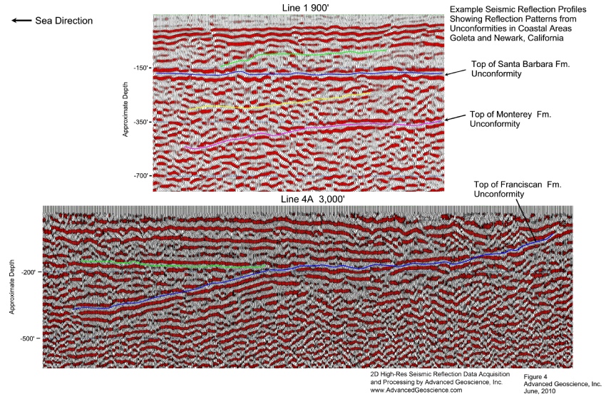
High-Resolution Seismic Reflection- Using Sledge Hammer, Seisgun, and Accelerated Weight Drop Energy Sources
- Investigation of Subsurface Geologic Structure and Stratigraphy
- Location and Mapping of Subsurface Faulting (Fault Plane Orientation)
- Mapping of Subsurface Bedrock Topography
- Investigation of Landslide Rupture Surfaces
- Detection of Deeper Subsidence Features and Sinkhole Forming Conditions
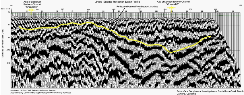
Seismic Refraction- Using Conventional and Tomography Methods
- Investigation of Shallow Bedrock Structure and Hardness (Bedrock Rippability)
- Location of Alluvial and Bedrock Channels
- Investigation of Subsurface Faulting

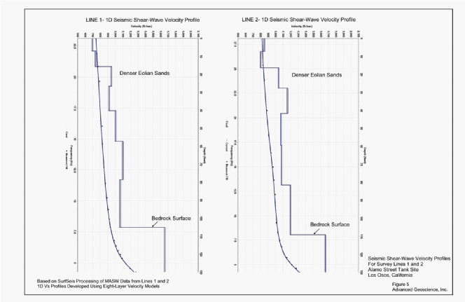
Multi-Channel Analysis of Surface Waves (MASW) for 1D and 2D Seismic Shear-Wave Velocity Profiling
- Evaluation of Earthquake Vibration Hazards (Vs 30m Measurements)
- Investigation of Shallow Bedrock Structure and Hardness
- Investigation of Soil Stiffness Before and After Ground Improvement
- Detection and Location of Subsurface Voids and Tunnels (Surface-Wave Backscatter Analysis)

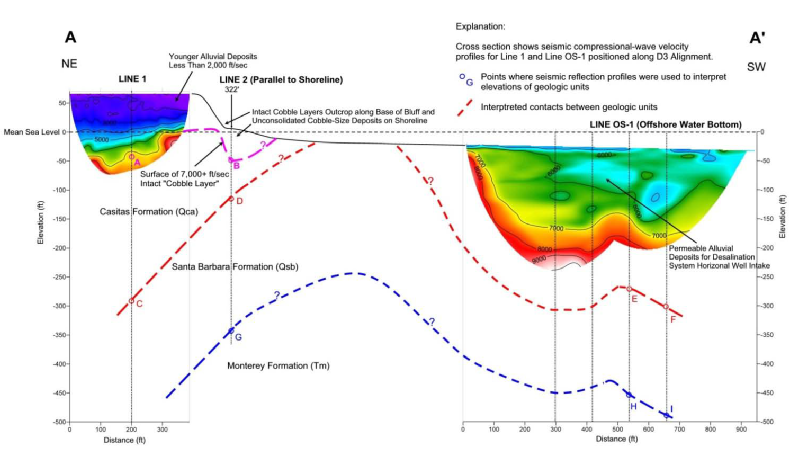
Offshore Seismic Reflection and Refraction- Using Water Bottom Cables and Towed Streamers
- Investigation of Subsurface Conditions for Desalination System Pipelines
- Profiling Depth to Bedrock for Pile Length Design for Piers
- Location of Alluvial and Bedrock Channels
- Investigation of Subsurface Faulting
Borehole Seismic Velocity- Using Downhole, Crosshole, and Tomography Methods
- Evaluation of Earthquake Vibration Hazards (Vs 30m Measurements)
- Investigation of Soil Strength at Building Sites
- Investigation of Subsurface Faulting Beneath Structures
- Measuring Travel Time for Seismic Reflection Correlation (“Check Shot” Survey)
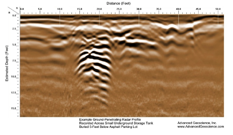
Ground Penetrating Radar 2D and 3D Surveys
- Delineation of Abandoned Underground Storage Tanks
- Location of Underground Structures and Pipelines
- Investigation of Former Burial Pits
- Detection and Location of Subsurface Voids and Tunnels
- Archeological Subsurface Investigations
Electrical Resistivity Profiling- Using Direct Current and Transient Electromagnetic (TEM) Methods
- Investigation of Groundwater Conditions
- Groundwater Well Location Surveys
- Delineation of Bedrock Channels
- Mapping of Clay Layers and Salt Water Intrusion
- Investigation of Embankment Dams and Levees
- Detection and Location of Subsurface Voids and Cavities
Combined Electrical Resistivity and Induced Polarization Surveys
- Investigation of Groundwater Conditions
- Mineral Exploration
Magnetometer Surveys- Ground Based Magnetic Gradiometer and UAV Drone Mag Surveys
- Detection of Abandoned Oil Well Casings
- Location of Abandoned Underground Storage Tanks
- Location of Pipelines and Other Underground Structures
- Archeological Subsurface Investigations
- Detection of Unexploded Military Ordinance
- Location of Volcanic Bedrock Fractures and Voids (Groundwater Exploration)
Gravity and Micro-Gravity Surveys
- Detection of Lateral Changes in Bedrock Lithology (Density)
- Location of Edge of Deeper Fault Basin Graben
- Location of Subsurface Voids and Cavities
Electromagnetic Induction and Ground Conductivity Surveys
- Location and Mapping of Underground Structures and Pipelines
- Location of Former Burial Pits
- Mapping of Clay Layers
- Archeological Subsurface Investigations
- Detection of Unexploded Military Ordinance
Services
Subsurface Geophysical Surveys

