Advanced Geoscience, Inc.
AdvancedGeoscience.com Los Angeles, California USA
Telephone +1 (310) 378-7480 Reno, Nevada
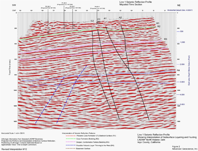
Seismic Reflection 2D and 3D Surveys- Using Vibroseis, Explosive, and Larger
Accelerated Weight Drop Seismic Energy Sources
- Investigation of Deeper Patterns of Subsurface Faulting
- Mapping of Sedimentary Basin Structure and Stratigraphy
- Investigation of Thickness and Volume of Deeper Economic Units
- Delineation of Oil and Gas Prospects- Hydrocarbon Traps
- Delineation of Geothermal Prospects- Deeper Fault Structure


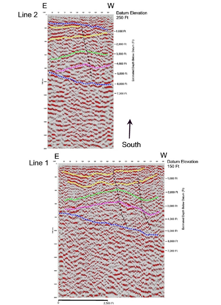
Two paralleling seismic reflection profiles for oil exploration along the edge of the San Andreas fault zone in California. Data was recorded in difficult terrain using explosive charges. The profiles show reflections indicating structural closure in oil-bearing Miocene units (green and purple lines) that are positioned between E-W trending fault planes (blue lines). Data recording, processing, and interpretation by AGI.
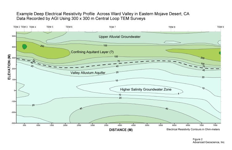
Deeper Electrical Resistivity Profiling- Using Transient Electromagnetic (TEM) and Magneto-Telluric Methods
- Investigation of Deeper Aquifer Layers and Groundwater Quality
- Delineation of Up-Welling Geothermal Brines
- Mapping of Deeper Sea Water Intrusion
- Delineation of Shallow Lateral Resistivity Anomalies Associated with Hydrocarbon Reservoirs
- Location of Conductive Sulfides and Ore Deposits

Combined Electrical Resistivity and Induced Polarization Profiling
- Location and Identification of Conductive Sulfides and Ore Deposits
Borehole Seismic Velocity Surveys- Using Deeper Downhole Methods
- Profiling of Deeper Seismic Velocity Layering
- Measuring Travel Time for Deeper Seismic Reflection Correlation (“Check Shot” Survey)
Lower-Frequency Seismic Surface Waves Surveys- Using Ambient Seismic Sources
- Profiling of Deeper Seismic Velocity Layering
- Evaluating Depth to Crystalline Basement in Sedimentary Basins
- Deeper Shear-Wave Velocity Model Building
Borehole Geophysical Logging- Using Gamma, EM Conductivity, and Electric Logs
- Investigation of Borehole Lithology
- Location of Permeable Groundwater Intervals for Well Design
- Evaluation of Groundwater Quality
Gravity and Magnetic Surveys
- Investigation of Sedimentary Basin Structure and Alluvial Thickness
- Delineation of Subsurface Volcanic Layers and Igneous Intrusions
- Absolute Gravity (IGSN71) Measurements and Ties to Existing Gravity Maps
Services
Deeper Seismic Reflection and Geophysical Exploration

